Sunday, January 12, 2014

Day 3, Part 2: Capernaum to Tiberius

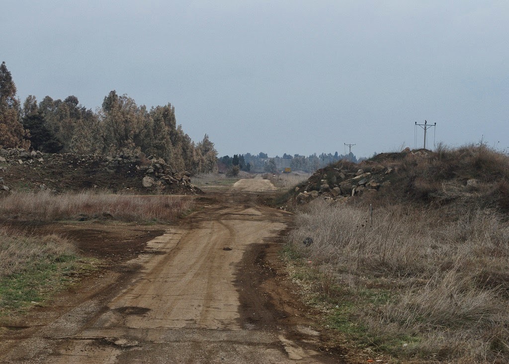
Our first day in Jerusalem went very well, although, if the days in Galilee were overwhelming, I think Jerusalem was doubly so at first.  There is just so much to see and take in, from the ancient history to the modern day city.  Also, perhaps I'm a bit of a country boy at heart, so being in Galilee was nice and pastoral.  The pace of Jerusalem is a bit more hectic.  So far, the death of Ariel Sharon has had little impact on our trip, at least that we can tell.  So, to go back a few days, here is where we were late Friday morning, descending the hills on the northwestern side of the Sea of Galilee toward Capernaum:


At Capernaum, we saw the ruins of Peter's mother in-law's house.  A church was built over the site in the 5th century AD, and a modern church has been built over all of it in the 1980s.  In this picture, you can see two walls of cut stone that would be from the early church.  The larger basalt stones (something we've become really good at recognizing by now) are from the house that would have been standing during the time of Jesus.  This house is where you have stories like the man being lowered through the roof to be healed by Jesus, as well as several other healings:


Here is a wider view showing the modern church that has been built above the site.  To the left are the ruins of the synagogue, so it would have been a short walk for Jesus to come here after teaching in the synagogue:


Here is a closer look at the synagogue.  Again, the darker basalt stone on the bottom is from the synagogue that would have been here during the time of Jesus.  The limestone above it is from when the synagogue was rebuilt in the 4th century.  This is one of the reasons why they're sure that this is Capernaum.  In the 4th century, Christianity had become the official religion of the Roman Empire, so it would make little sense for the state to sponsor the construction of a synagogue in this place, except that they wanted a place to show pilgrims what the synagogue may have looked like in Jesus' time.  


Here we are on the seats inside the synagogue.  Again, this is not the synagogue Jesus would have been in, but it's on the exact same site and looks very similar:


There are some other pieces of the synagogue on display that we looked at as well.  This shot shows the Roman Catholic church that's been built here.  The Franciscans are the protectors of many of the holy sites that we are visiting.  


A picture next to the mosaic welcoming you to Capernaum, the town of Jesus:


From there, we went to lunch at a restaurant just down the road by the Sea of Galilee where we had the chance to try St Peter's fish, so named because of the story in Matthew where Peter catches a fish with a coin in its mouth.  


So here is our lunch of St Peter's fish (Tilapia), deep fried.  Many of us had it served with the head on, but none of us found a coin:


After lunch, we drove to the top of the Mount of Beatitudes, a hill just south of Capernaum overlooking the Sea where we remember Jesus' preaching the Sermon on the Mount.  There were only 25 of us gathered to listen to Pastor Art read the Beatitudes from Matthew, but in Jesus' day there were great crowds of thousands who had gathered to hear him in this place (minus the trees and steps and shrubbery, of course):


The church that has been built on the site, looking toward the Sea of Galilee.  The inside is eight-sided to remember the eight Beatitudes:


The altar inside, also eight-sided:


The view from the church back down the hillside to Capernaum, showing you how close this site was to the town.  Capernaum they believe would have had around 5000 people living in it during Jesus' time.


Our next stop was a few more miles to the south at Tabgha, where it is believed Jesus fed 5000 people with just a few loaves of bread and two fish.  This site was chosen because it is not near any ancient town, and the Gospels say that the people were hungry and didn't have anywhere nearby to get food.  Here is one of the doors into the church:


The altar built over the stone where Jesus may have blessed the loaves and fishes.  The present church is more modern, but some of the mosaic floors are from an earlier ancient church.  You can see the mosaic that this church is famous for with the two fish and basket of bread between them:


A close up of some of the ancient mosaic tiles:


Again, we traveled a bit farther south to a site called the Jesus Boat where they have uncovered the remains of an ancient boat that would be similar to the boats in Jesus' day.  This is where we got on our own boat for an evening ride down to Tiberias to end our day.  The boat we rode, a modern boat made to look a little more like the boats of Jesus' time:


In the middle of the ride, Pastor Art read the story of Jesus walking on water and inviting Peter out onto the Sea.  It was a pleasant evening with very calm seas, so no calming of the wind and waves was required for us.  We had a nice ride and a good view of Tiberias where our travels for the day ended and we headed back to the southern end of the Sea to our hotel at Maagan.  Tiberias was a city in Jesus' day, but not a place that he visited because it was a Gentile city.  Here it is from the Sea:


So that gets us through Day 3.  I'm now two days behind, but hopefully I'll be able to catch up a little bit during part of our free day on Wednesday.  Today we're traveling from Jerusalem to the Dead Sea, including a tour of Qumran where the Dead Sea Scrolls were discovered, and we'll also stop in Jericho to see that ancient city where Joshua and the Israelites fought their famous battle of Jericho.  Keep praying for us and feel free to leave more comments.  Peace to you from Jerusalem.

+PBK


Saturday, January 11, 2014

Day 3, Part 1: Golan Heights, Caesarea Philippi, Dan

Greetings from Jerusalem!  We arrived here yesterday evening after another full day of touring where we traveled from Maagan on the Sea of Galilee up to the top of Mt Carmel, then down to the Mediterranean Sea at Caesarea, before finally driving through Tel Aviv and on here to Jerusalem.  I finally caught up on some sleep last night, so I'm feeling refreshed as I try to catch you up on our travels.  Our third day of touring began in Maagan where we had to wake up plenty early and get on the road by 6:30 to avoid a marathon that was going to be happening on the highway around the southern end of the Sea of Galilee.  We drove along the eastern shore of the Sea, up to an area called the Golan Heights.  Our first stop was at the location where they believe the story of Jesus casting out a Legion of demons into a herd of pigs took place.  I realized I hadn't shown you a picture of our guide, Gila, so here she is telling us about the pigs charging down the hillside and drowning in the water, and that the geography of the place makes this the only likely spot that this could happen.  Gila has been wonderful.  She's a Jewish ex-pat from Connecticut who has been living in Israel since 1973 and guiding tours for over 30 of those years.


Here's a view from the site looking across the Sea of Galilee to Tiberias with a sign that would become familiar during our journey this morning.  This area was mined during the conflict with Syria.


From there we traveled a bit farther north before turning east away from the Sea and up into the Golan Heights themselves.  Here's a view looking back to the northern end of the Sea.


It was a bleak and cold morning to drive through a desolate place like this where so many battles have been fought, including modern tank battles between Syria and Israel.  Many wondered why there would be so much fighting over land like this, but with the commanding view of the Sea of Galilee and the Jordan River valley, it has been vital to Israel's well being to keep Syria out of Golan. And a reminder that even in dark places and times, the light can still break through:


An Israeli war memorial at a particular intersection:


After some more driving, we came to this overlook where you can view the Syrian border.  The small white buildings in the middle are at the border.  The larger white buildings off to the right is the UN compound in the narrow demilitarized zone between the two countries.  In the foreground are some of the many orchards and vineyards we saw in this area, and we saw some people at work in them as well.  I'm sure the view looks much more beautiful in the spring and summer, but on this day we got a bleak picture into a place where there is a lot of violence and suffering right now.


As we traveled away from the Syrian border to our next stop, we passed this road that our guide told us is the old road to Damascus, the road on which Paul had his conversion, although that was probably closer to Damascus, about 50 miles from this spot:


We drove through the town of Buq'ata and encountered this shepherd with his herd of sheep and goats:


Then we stopped at cafe near Mt Hermon for coffee and some delicious baklava:


Mt Hermon was visible when we went into the cafe but clouds moved in by the time we came out.  On our way back down out of the hills, they parted just enough to get a glimpse of the highest mountain in Israel in the distance:


Our next stop was Caesarea Philippi, where Jesus brought his disciples before beginning their journey to Jerusalem.  It's the site of some springs that form part of the headwaters of the Jordan River as well as an ancient Greek temple to the god Pan.  I thought you might want to see this little guy, who doesn't have a name, but is sort of the new mascot for the Israeli National Park service, like Smokey the Bear for us.


Our group as Pastor Art reads for us the passage where Jesus gives Peter his name and says "On this rock I will build my church."  Pastor Art told us that it was significant that he said that in this place because there are the rocks of the mountain, the rocks of the temple, and the stone idols that would be placed in niches in the wall of the temple.  So Jesus was saying the church would be established, not on this rock or this rock or that rock, but on the rock of Peter's faith, and Art reminded us that the church continues to be built on faith.


A view across the water coming out of the spring called Banias, and looking toward the cave or grotto that is the oldest shrine on the site:


Another view of Pastor Art reading for us from the Psalms after we spotted some wildlife that are referred to in several places.  I tried to get a decent picture of them, but they were too far away and in some bushes, but they kind of looked like small ground hogs or large guinea pigs to me:


Then we walked up to the grotto itself:


One of the niches in the cliff where a stone idol would have been placed:


An overview of the site from another location:


Our next stop was at Dan at a nature preserve where we could walk and see another set of springs and a river that are more of the headwaters for the Jordan River, as well as an ancient temple on the site.


Here is our group on the trail, looking at some of the water rushing down toward the Jordan River:


They were looking at the Dan River, one of the three sources for the Jordan River:


After a while we stopped at this reflecting pool:


Pastor Art read for us the story of how, after the kingdom of David and Solomon was divided in two (Israel in the north, Judah in the south), King Jeroboam (one of Solomon's sons and ruler in the north) set up shrines complete with golden calves in Bethel and Dan so that people in the northern kingdom would not return to the temple in Jerusalem in the south to worship.  This was sort of the beginning of the end for the northern kingdom as they turned to idolatry.


After another short walk up the trail, we came to this large pistachio tree:


From there, we could look to the north and see the northern border of Israel with Lebanon, marked by the hills in the distance:


Here, our guide took the time to answer many questions about Israel, both in the distant past and in more recent history.  I wish I could tell you all of it, but you'll just have to be content with this picture for now:


Finally, the last thing we saw on the site was the ruins of the temple at Dan, built around 1700 BC.


From Dan we traveled back toward the Sea of Galilee to go to Capernaum, the town at the center of Jesus' ministry in the Galilee region.  As we made our way there, still north of the Sea, we drove past this site, called Hazor.  It was the largest fortified city in the area during the Canaanite period, so contemporary to the fortress at Megiddo that we saw the previous day:


As we made our way down toward the Sea of Galilee and Capernaum, we also drove by the city of Chorazin, listed in the gospels along with Capernaum and Bethsaida as places where Jesus performed miracles.  It's also one of the places that Jesus denounces when he says "Woe to you Bethsaida, woe to you Chorazin."


That's all the time I have for now.  We have another big day ahead of us as we travel to Bethlehem and begin our explorations of Jerusalem.  Stay tuned and peace to you.

+PBK
Friday, January 10, 2014

Day 2, Part 2: Megiddo and Belvoir

It's almost 8:30 PM here by the shores of the Sea of Galilee on our last night at Maagan.  Today was the longest day of touring that we've had so far.  Because of a marathon being run around the southern end of the Sea of Galilee, we had to be up and on the road by 6:30.  We ended our day with a nice boat ride on the Sea and didn't arrive back to the resort until after 5:30.  I'll try to get us caught up through the rest of yesterday (Thursday) this evening before I crash into bed.  Tomorrow we aren't leaving as early, so I should have time to do some more in the morning.  I'm trying not to get too far behind, but there's so much I want to share with you all!

So, picking up where we left off in Nazareth, we left the site of Mary's well and drove out of Nazareth toward the ruins of Megiddo.  This took us south out of Nazareth and into the Jezreel valley, through the town of Afula and then west to the site of Tel Megiddo.  (In Hebrew, Tel means "mound," particularly a mound with ruins on it.)  Here is a view coming down from Nazareth into the Jezreel valley.  Here we're looking to the south-southeast, toward the town of Nain where Jesus raised the widow's son.  


After a 20 minute drive or so, we arrived at Tel Megiddo:


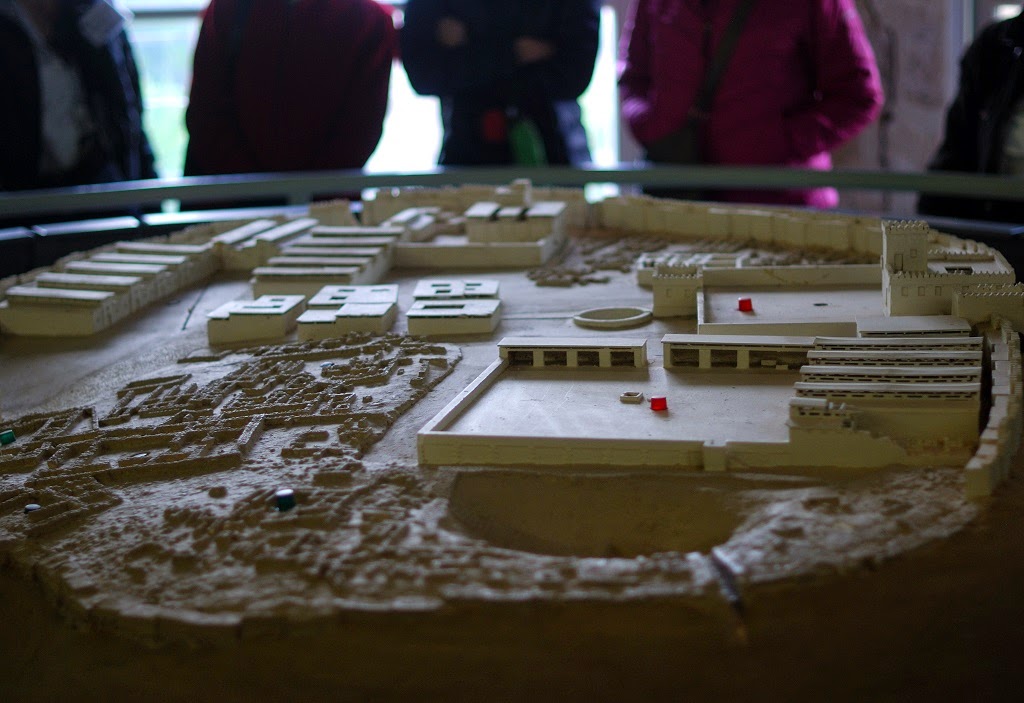
Megiddo is an ancient fortress built on top of a hill overlooking the intersection of two roads.  There are several layers of history here that are too much to share with you in such a short time, but I will do my best.  The oldest evidence of some kind of habitation at the site dates back to almost 7000 BC, so we're talking very very old.  The site was occupied in some form until 586 BC, the time of the conquest by the Babylonians.  This makes the site a rich archaeological site because later construction has not disturbed anything since that time.  It's believed that the site functioned not only as a garrison and fortress, but that later construction during the time of Solomon included stables for some of his famed horses.  This may have been a place where the horses were trained to work in pairs to pull chariots.  Another main feature of the site we would get to experience is the tunnel that was dug to allow access to fresh spring water from inside the walls of the fortress.  This is the inspiration for the fictional account of a well that is discovered in a tel in James Michener's famous novel "The Source."  As we began our tour of the site, we gathered around this model of what the city may have looked like during the time of Solomon.  The gates are out of frame to the left, some of the stables are in the upper left, the main fortress and palace is on the right with more stables in the right foreground, and the hole going down to the water tunnel is in the foreground.  In front of the hole you can see a small crack in the wall that was first opened to allow quicker access to the spring before the hole and tunnel were dug.  Before this, the women would have to leave through the front gates and walk around the walls of the fortress to get to the spring and draw the water, then carry it all the way back in through the gate.   


Hopefully that gives you enough orientation, although we got a lot more detail than what I've given you here.  As we entered the site itself, we passed by some of the original stairs leading up to the fortress.  Remember, we're talking about things that are over 3000 years old!


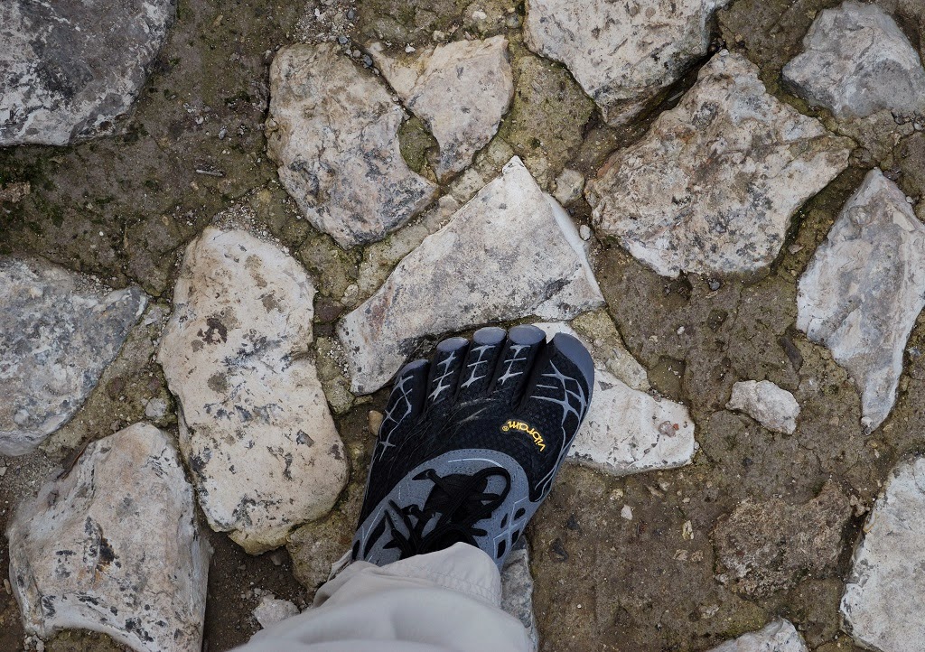
As we walked through the ruins of the gates, our guide told us that we were now walking on the original stones from the 15th century, BC.  I had to stop to take a picture of my foot on one of the stones, also to show you my shoes that everyone has been so interested in.  I've got a separate blog about running and why I like these shoes, so I won't bore you with that now. Anyway, this is my foot on a stone that was placed here and walked on by ancient people at least 3500 years ago:


This is the view from the front gate of Megiddo looking back to the north across the Jezreel valley to Nazareth. 


Here is Pastor Art charging through the gates of this impregnable fortress (this is what happens when the pastors are the last ones in the group):


Here is the rest of the group exploring the site as we make our way from the gates up to the first stables:


Here are the remains of the stables, again looking across the Jezreel valley toward Nazareth.  Note that some of the stones are newer and were placed here to give you a more complete picture of the site.  I included this picture mostly so you could see both Nazareth on the hillside in the distance on the middle left, but also Mount Tabor standing alone just to the right.  This is most likely the Mount of Transfiguration.  We won't travel there as it's a long journey by taxi to the top, but I thought it was nice to see.  This also gives you an idea of why this fortress was so important with a commanding view of the entire valley.  This is a good time to share with you the other reason this site is significant to us.  In Revelation 16, when John says there will be a great massing of the armies of good and evil, he says it will take place at "Armageddon."  This comes from the Hebrew "Har Megiddo" or "hill of Megiddo," so if you're wondering where the final battle between good and evil will occur, according to John it's going to take place right here in this valley.  


As we left the stable area, we passed this strange round stone at the bottom of one of the more recent excavations.  Our guide told us that it's solid basalt, and they're not sure what it's for, but it dates to the Bronze Age, or somewhere around 7000 BC, so it's evidence that there was a settlement here even then.  They're doing more research about it before digging any deeper, so we're just kind of in awe of this strange ancient stone:


This area of the fortress was the cultic or ritual center, with the large circle of stones most likely being part of an altar for sacrifices, in Canaanite times (before they were conquered by the Israelites) perhaps even child sacrifice. 


In the middle of the ruins, we were able to look inside the largest ancient grain silo that's been found in the Middle East.  One farmer among us wondered if it was made by Sukup:


After seeing the other stables, it was time to descend into the well and walk through the ancient water tunnel to the spring on the outside of the fortress.  As we decended the many stairs into the well, we saw the ancient stairs along the walls.  These would have only gone down so far to a place where there would have been buckets to draw the water up, so the women would not have gone all the way down to the tunnel like we did.  The tunnel simply brought the water from the spring outside the wall inside the fortress so they could draw it up.  Our guide said that while this certainly saved the women many steps and protected them from attack, it was probably built more as a protection for the water source itself rather than out of concern for the women, although I'm sure they were glad for the "convenience" of it.


Like all tunnels, this one was of course rather dark, so the best I could manage picture-wise without using the flash was this closeup of the tunnel wall, hand dug of course:


After we emerged at the spring, we walked up more stairs (thankfully less on that side going up than we walked down from the inside of the fortress) to a parking area where our bus was waiting for us.  We drove back to the main entrance and had our lunch at the cafeteria in the park.  After lunch, we left Megiddo and went back east toward the Jordan River valley to Beth She'an, then north along the same road we took the evening before to Belvoir Fortress.

The name Belvoir is French meaning "good view" and it's appropriate, because to get there we drove up a winding road to the top of the hills overlooking the Jordan River valley.  Belvoir is a Crusader fortress that was built in the 12th century AD as the Crusaders fortified themselves to defend against Muslim invaders. The fortress only lasted about 50 years until it was dismantled after coming under Muslim control.  I decided I'd try to be a Crusader defender, too, if only for a moment.  I don't think I would have fared any better than they did:


To get to the ruins, we first crossed the moat:


The architecture was exactly like what you'd expect from a typical Medieval castle with an outer wall, an inner wall, and then a fortified keep in the middle.  Here is one of the arched entrances to the keep area:


This is looking east through the outer wall toward the hills of Gilead in modern day Jordan on the opposite side of the Jordan River.


Here is part of the view from the eastern wall of the fortress (without the wall, of course), giving you an idea of how commanding the vantage point was and why it was named "good view."  This is looking northeast, with the Sea of Galilee on the far left and the hills of Jordan beyond the river valley to the right.

Crusad....I mean, Pastor Art, surveys the valley from his most recently conquered fortress of the day:


One final look across the valley from inside the fortress


On our way out of the fortress we stopped in the keep and took some more pictures, but we had to be somewhat quick about it because we were the last group of the day and the person at the gate said they were leaving at 4 whether we were gone or not :)  That was the end of our touring for the day.  We returned to Maagan and stopped at a shopping center along the way to buy some beverages, something our guide said she had never done with a group before.  It was fun to go into an Israeli supermarket, and I bought some Israeli chocolate to bring home for Lindy and the boys.  After that, it was time to head back to our resort to relax, enjoy supper, and get some rest before our big day around the Sea of Galilee that we had today.  If I can get the pictures ready this evening I'll post about that in the morning before we leave Maagan and the Sea of Galilee and head toward Mt Carmel and the Mediterranean Sea at Caesarea before ending our day in Jerusalem, and since it's Friday evening here, I'll say farewell with the appropriate Jewish greeting: Shabbat shalom or "Peaceful Sabbath."

+PBK